
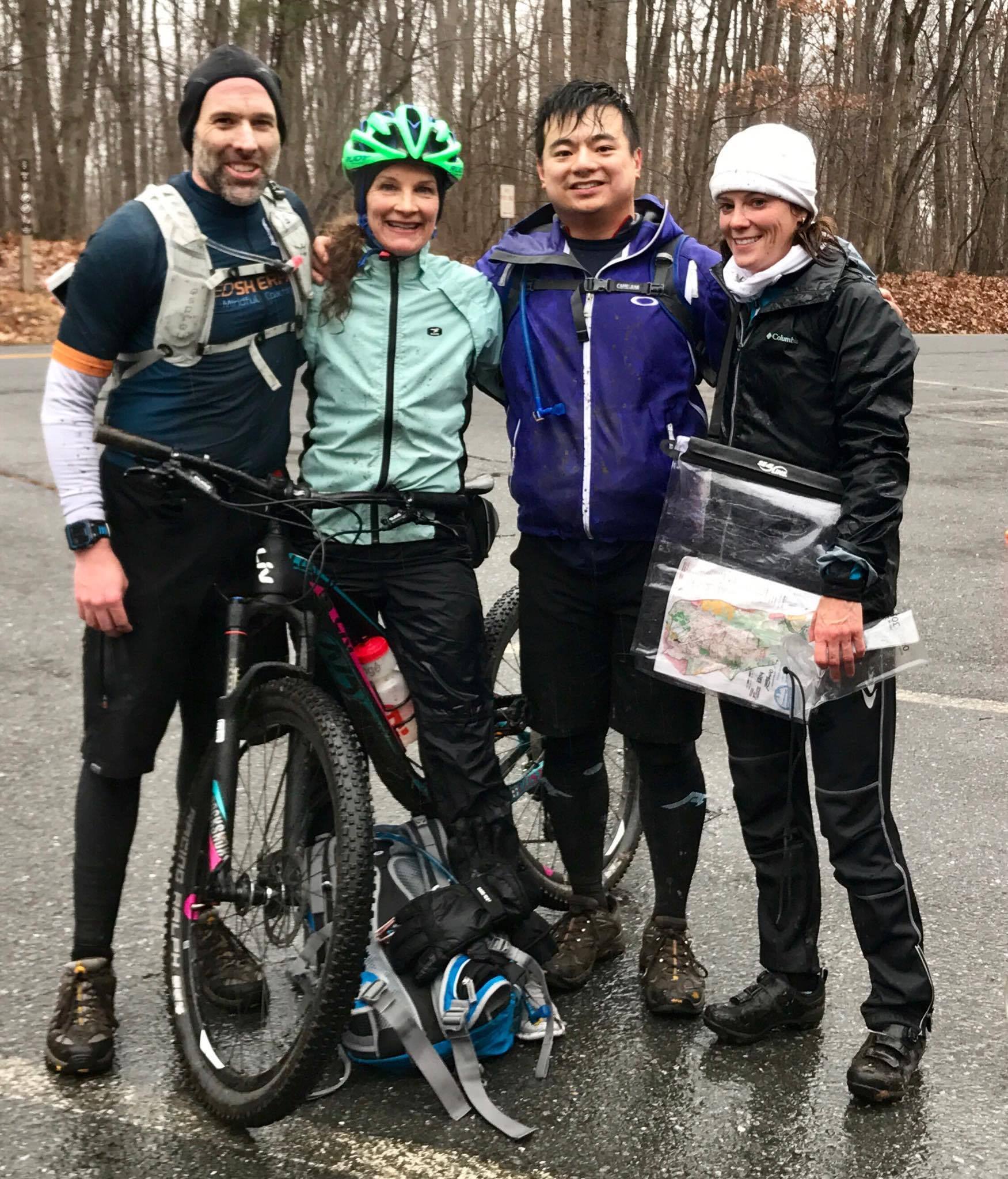
It was great to get back into Adventure Racing as I wasn’t able to do any in 2016. This time I stepped outside my comfort zone and registered for a race that was local vs. being dependent on my brother-in-law in Missouri taking care of everything (bikes, gear packs, getting us to/from the race, orienteering, etc). I was able to trick recruit three other Speed Sherpa teammates to try Adventure Racing while take a stab at being team captain… which really means acting as a “sherpa” to ensure everyone is prepared, ready for a great time, and does not include being able to read navigational tools (more details below).
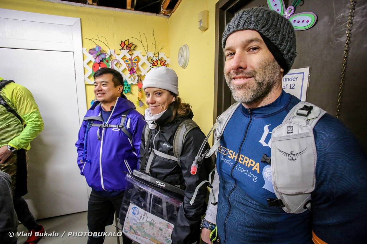
The morning started with sleeping in till 5am (usually 4am) eating my usual pre-race breakfast of english muffin with (the best named) almond butter and I was off on the road. It took just over an hour to get to the race location, which was good because once again Google Maps does NOT like park references as I soon found myself at the parking lot for servicing county vehicles. Finally realized that the race address technically has two locations, that are a 1/4 mile apart from each other, I was able to find the race parking location and headed towards race check-in. The weather was not showing any signs of a light winter snow as predicted the day before, but more of a wet/cold/icy mix. Not the most ideal of race conditions, but it’s the middle of January… so what would you expect! We picked up our race packet, signed our lives away our waiver, and collected our race bibs where we discovered we were race team #13, so we pinned our numbers upside down as dictated by “the rules”.
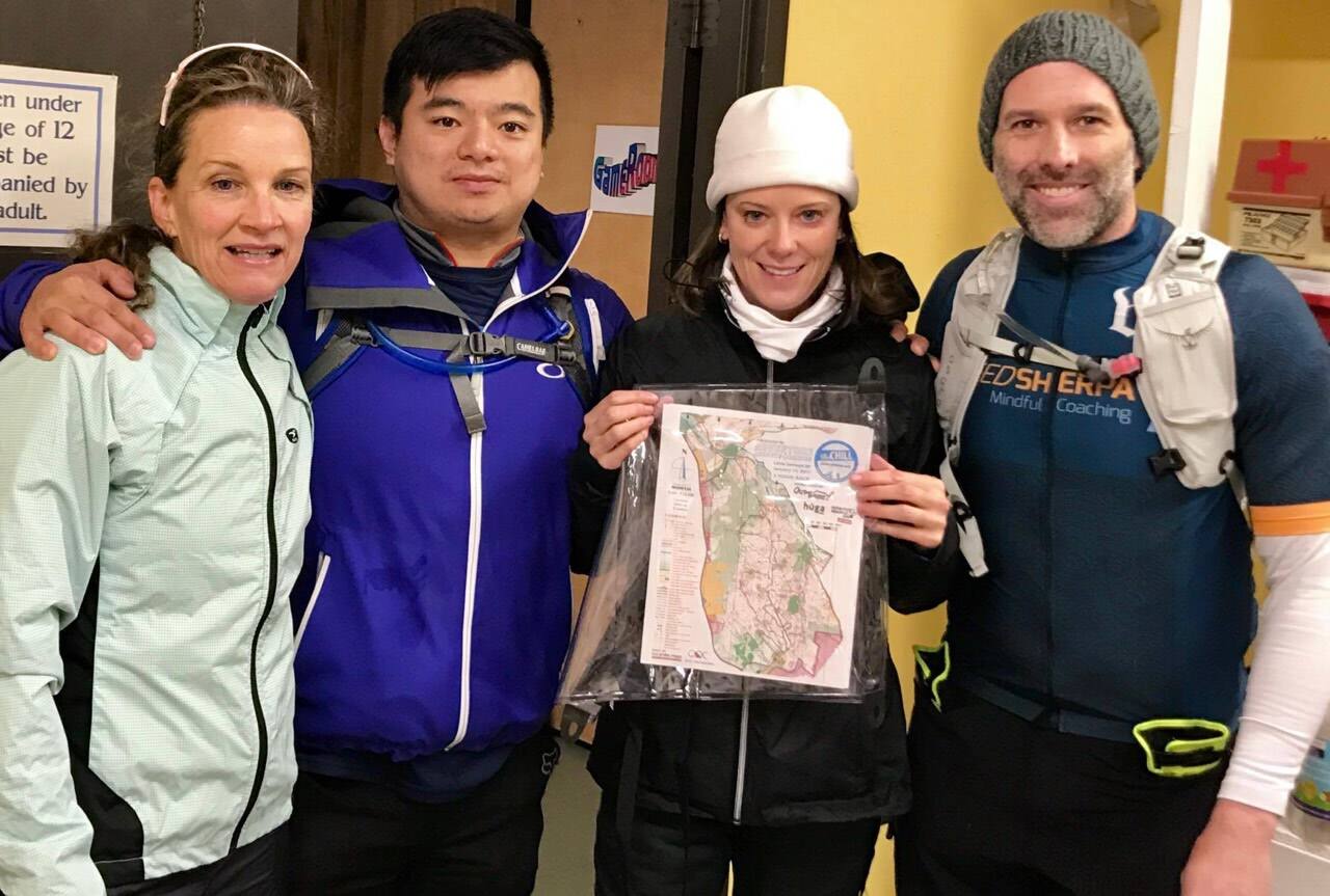
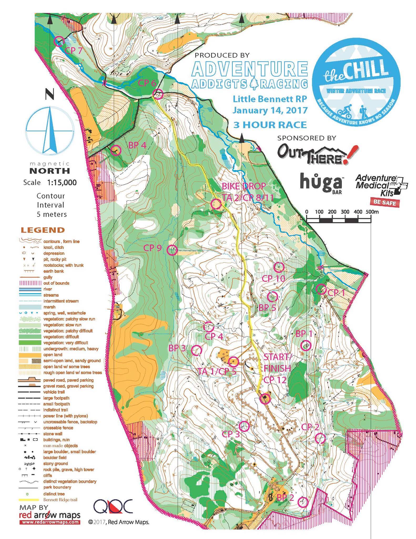
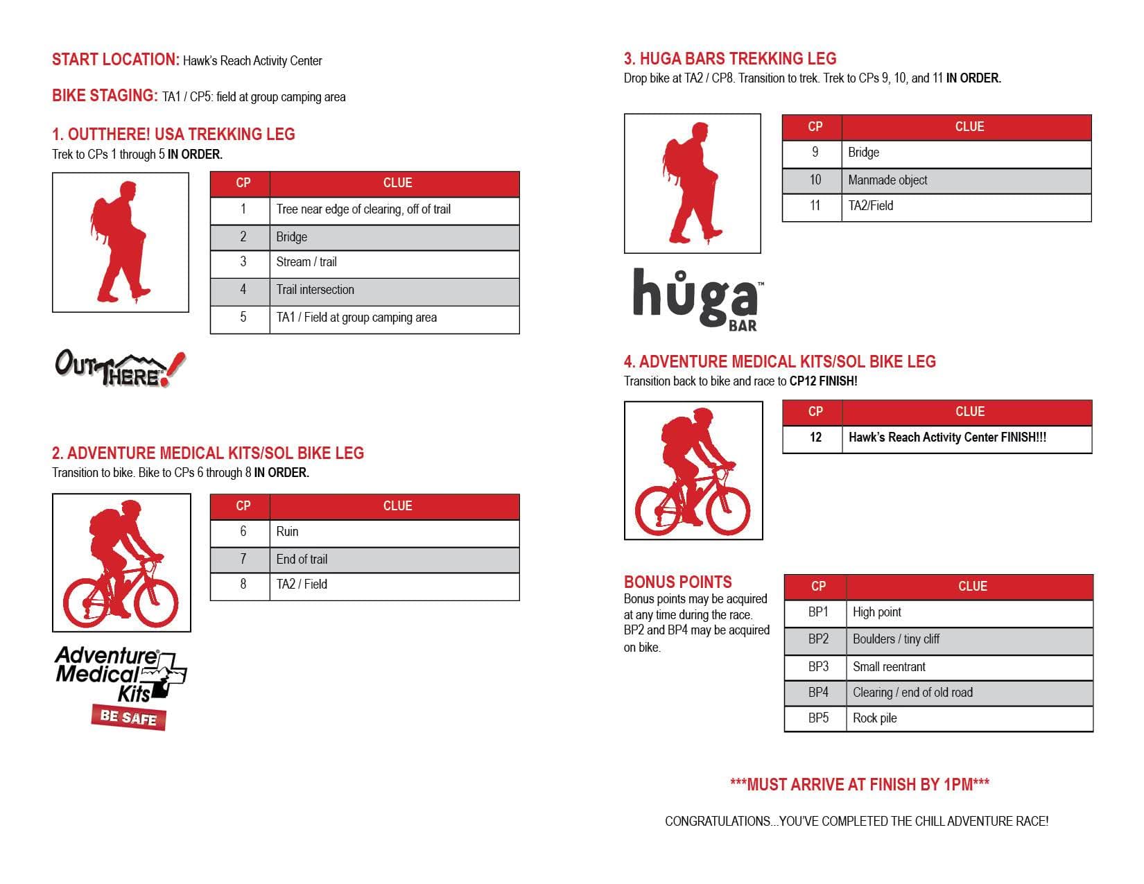
The pre-race debrief for the 3hr race participants was perfect. It catered to the novice individuals which was almost 50% consists of first time racers, but also let the veterans know of some particular rules that you may not have expect. The one that threw me off is you had to capture the checkpoints in order vs. being able to hit them in ANY order as I had previously experienced when racing in Missouri. We initially had concerns teams would be bunching together at the race start, but we soon found out NOBODY had the same idea on how to get to the first check point so bunching was not going to be an issue throughout the race. In the pre-race debrief we were provided the below map1 along with the Check Point description sheet2 to review and were allowed to ask questions. Here are the main points:
- You must grab all the mandatory Check Points (CP) in numerical order.
- Bonus Checkpoints (BP) can be picked up at any time, but only BP2 and BP4 can be picked up while on the bike segment
- The yellow line traveling from CP5 to CP 6/7/8 (and potentially BP4) is the only path you can ride your bike, else bikes are off limits in the park.
Beginning Run
It was finally 10am and everyone is ready to start. We set ourself towards the back of the path as even though we had mapped out our route, we forgot about the beginning so we just decided to watch which way others were heading. When the start siren blasted, we were off and quickly found ourselves in the front pack with our previous endurance training. Truthfully, we haven’t got into endurance training as it’s only the middle of January which starts triathlon season, but our off season is still above everyone else. We quickly did find ourselves in the front of all the 3hr race participants and began navigating to find the first checkpoint. This is where we soon realized that our navigation skills will be the our downfall. Some of the highlights include:
- Finding BP1, we were not sure if we were in the correct location. I was confident in reading the map and the surroundings correctly and began exploring. After a couple of minutes, I was able to find BP1 but we lost some time standing and deliberating trying to determine our true location on the map.
- After CP2 we thought we found the road to cut across to pick up CP3, but again LOTS of time waisted trying to asses our true location as what we were seeing on the map did not match with what we were seeing around ourselves. This was the most “LOST” we would find ourselves all day, but it was very heart breaking that after 2 CP and 1 BP we felt hopeless in our navigation skills.
- We think we found CP3, but in reality we found the 6hr race CP2 because both descriptions slightly matched what we found of a “Ruin” and “Stream” (the CP was on the root size of a 6’ base from tree blown over… on a stream).
- We found fellow racers and finally got ourselves oriented on the map, however, again was off the map as we were not used to the markings. At this point I started naming elements to describe where we were located (such as “The Chicken feet path” vs. where we were wanted to be located).
- After really finding CP3, we lost more time deliberating where we were really located and which direction to go (the CP was in the middle of a Y). This is where I earned the dunce cap of the day as I was reading the compass backwards thinking the RED line was South vs. North.
- BP3 was a perfect learning opportunity because the description was “Small Reentrant” and I knew exactly what that meant, but couldn’t effectively describe. When we came to the spot, I was able then to explain with words and right down the middle was the BP flag.
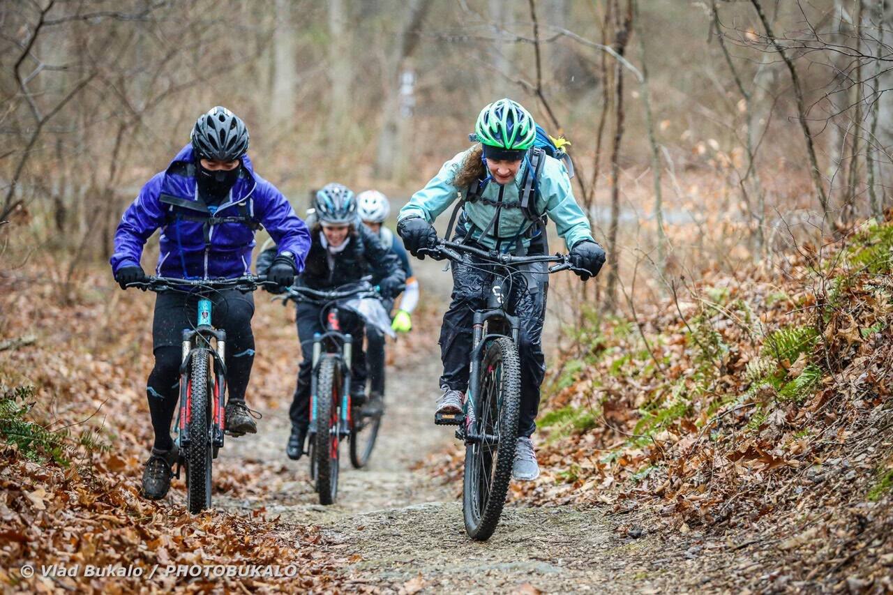
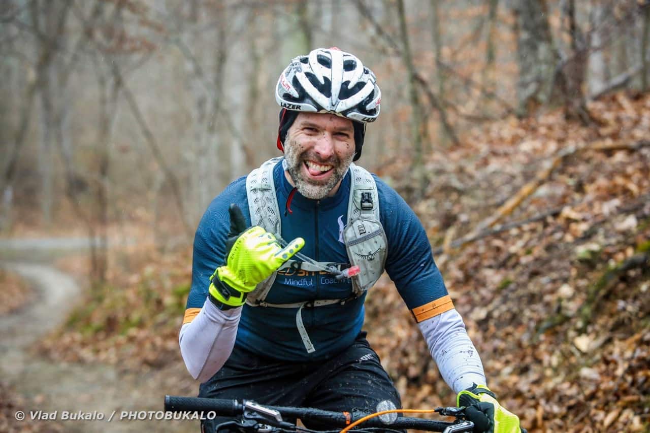
MTN Bike Segment
Thank goodness we are on the bike! With a team of triathletes we excel at the bike and we were ready to catch some ground as we felt like we were now behind with so many times not moving during the first run portion of the race. However, we had one setback as we forgot race briefing #3 that we could bike the trail, even though there is an obvious sign of “No Biking” posted at the beginning (take a look at the Strava link below, we make a nice circle of waisting time). We quickly blazed through the trail to CP 6 and 7 flawlessly, and on the way back snatched BP4 which was a demanding uphill climb, but the CP was easy to find. On our way back to CP8 and the 2nd run transition, fatigue started to set in on the legs (from getting BP4) as we were climbing again but now in some thick, wet, goopy, icy, mud.
The plus side is our spirits were up after accomplishing so much during the bike portion, but also nerves were kicking in as we had 40 minutes left of the race and still more trekking to accomplish to get the final checkpoints.
Second Run
Back to trail running, we set out to find CP9 which was easily found as it was right off the trail. However, we had originally planned on going strait across to CP 10 following the stream, but found ourselves in that the stream was also covered in thick trees and high brush that was not passable (at least not by our bushwhacking skills). We quickly decided to continue on the trail, round back the yellow line to cut right and pick up CP10. Once CP 10 was picked up, it was back to the bikes (CP11) and the sprint to the starting point for the final CP of the day (CP12).
Race Results
This was such a blast! And I think I have successfully converted three fellow teammates to do more Adventure Races with me in the future. The race organizers were very helpful, but also reasonably strict when the race was actually in session (CP8/11 had volunteers. We asked to confirm “Is this CP 8”, and they properly replied “we cannot confirm or deny”). Some of the things I learned were:
- It’s a 3hr race. You do not need 1.5L of water. I should have known this beforehand as when I did the Perfect 10 Rogaine (10 hr Adventure Race) I only filled my bag with 2L of water. Better planning next time.
- Fully read the directions to get to the race facility, there may be clues.
- When planning your route, don’t forget the starting line.
- I really need an orienteering class. This will help so much, and may lead me to try a solo race.
- You can play it safe and only follow trail lines to get from CP to CP, however, this also adds a lot of time and may not lead to getting any of the additional BP. Need to find a balance of staying on a trail, and bushwhacking through to makeup time.
- For the 3hr race I’m glad I swapped out my MTB clip-in peddles for some traditional flat peddles. But I think for a 6hr race (or more) there is a lot of advantage for having clips to get you around the more difficult trail segements as witness when our paths cross some of the 6hr racers.
- The red part of a compass is north.
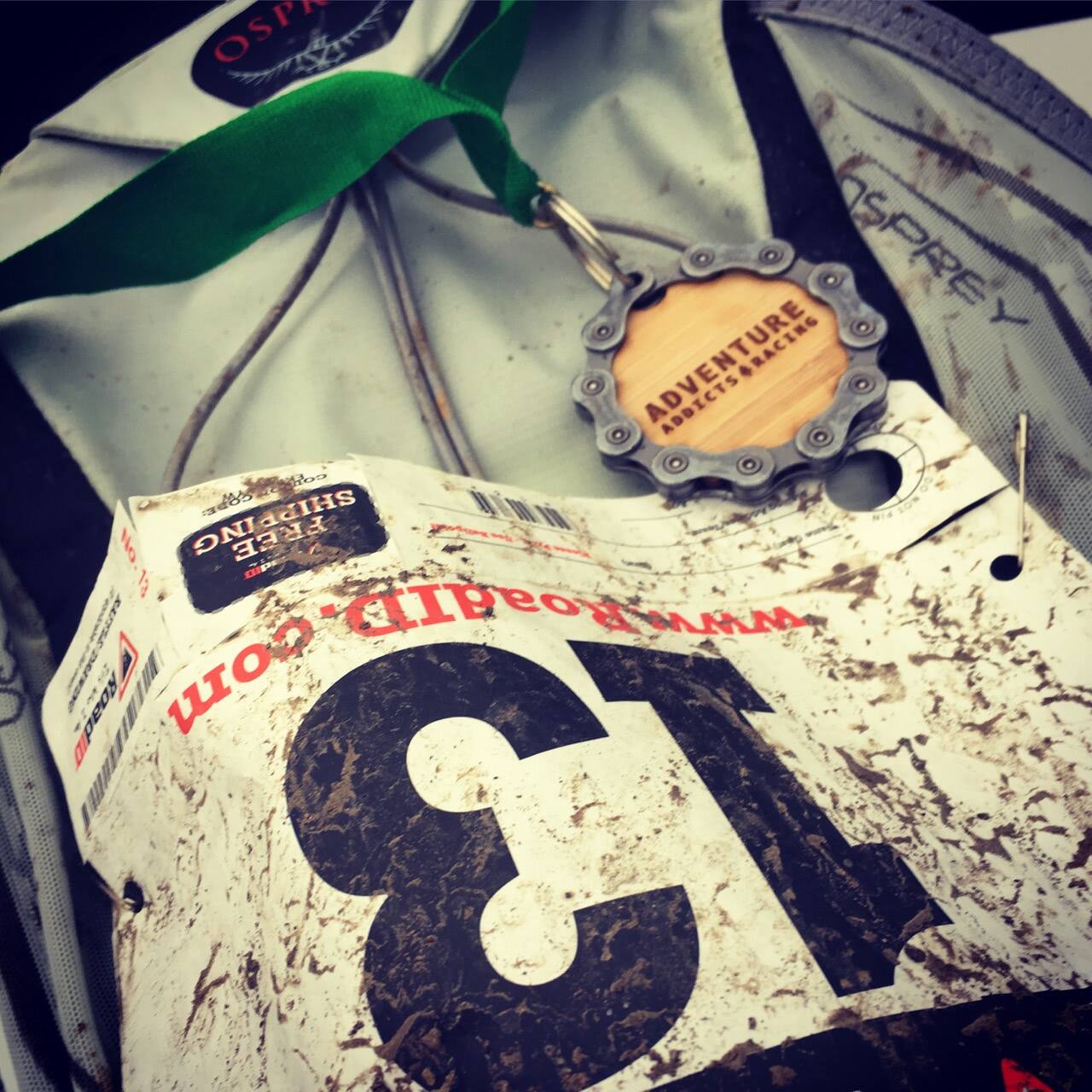
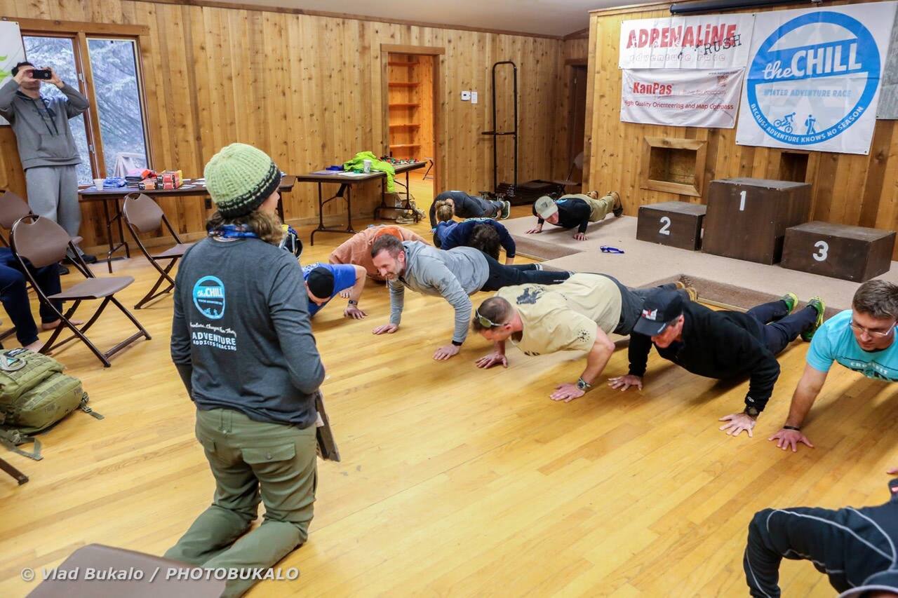
After the race there was a GREAT post-race food and awards ceremony. There was also a fun push-up competition that I participated in, but had no chance of winning as this brick wall of a guy just powered through as people dropped one-by-one. I also won a free Road ID out of the raffle, and won a free book by confessing the embarrassing story previously mentioned of reading the compass incorrectly that the red line points north. The book title is “Squiggly Lines” by Mark Lattanzi and is set to be available March of 2017, but you can pre-order on his website’s store: www.tanznavigation.org/sqlines/index.php.
Rankings
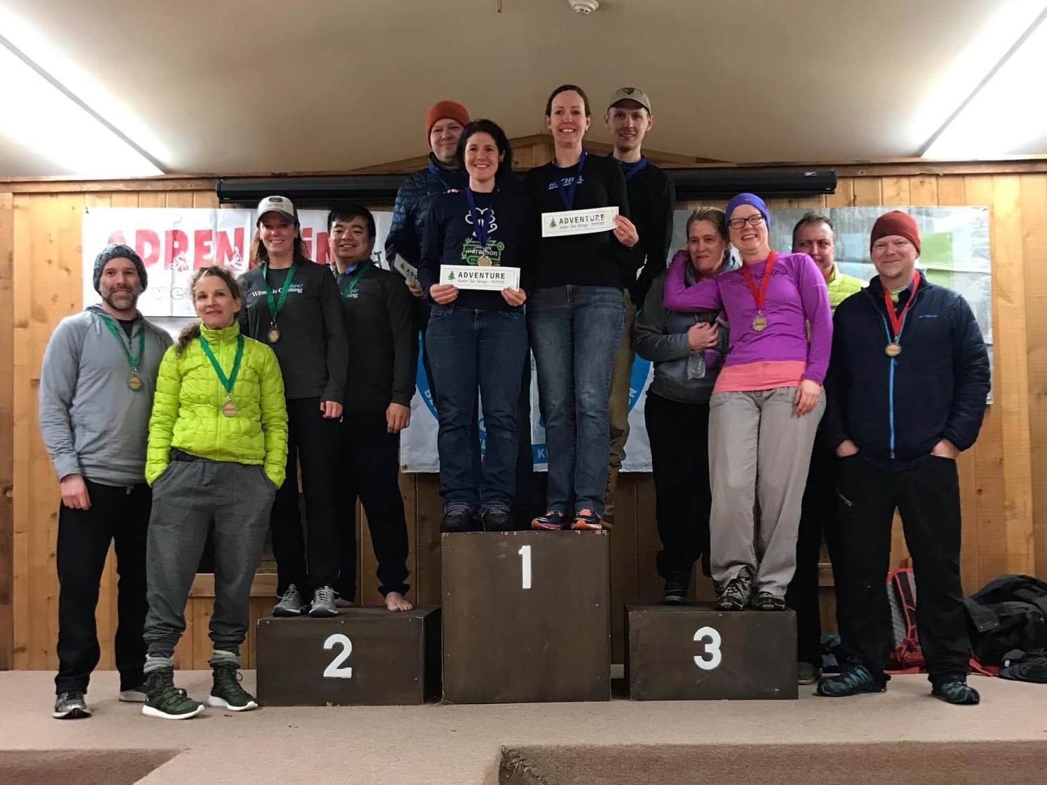
- Overall: 2nd place for the 3/4 Co-Ed category! (out of three)3
Updated 2017-01-19 (Race Photos by Vlad4)
Footnotes
-
Official Race Results available at “The Chill” Results page. ↩
-
Vlad’s Facebook contact site ↩
Comments are closed. If you have a question concerning the content of this page, please feel free to contact me.